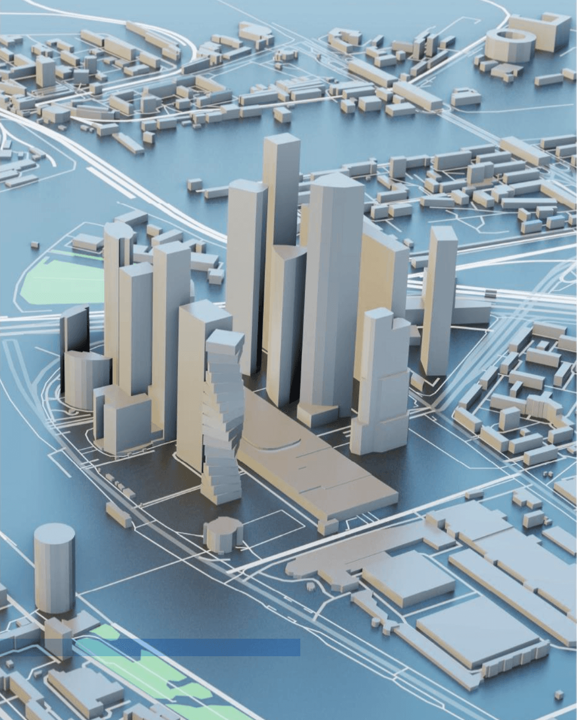
THE IMPORTANCE OF LEVELS OF DETAIL (LOD) IN 3D MODELS
In the era of Smart Cities, Digital Twins are fundamentally changing how we manage infrastructure. However, simulating the real world in cyberspace is not merely about drawing 3D models. In practice, to efficiently manage vast amounts of data, experts use the concept of LOD (Level of Detail).
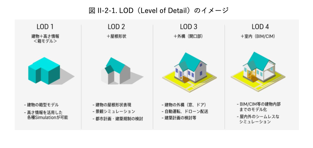
According to the international CityGML standard, the level of detail of a 3D object (such as buildings, transportation, or vegetation) is divided into 5 basic levels, from LOD0 to LOD4. A clear understanding of these levels helps managers make data investment decisions appropriate for specific objectives.
Characteristics of LOD Levels in 3D Models
The LOD concept allows us to control the level of abstraction or detail of an object. According to the international CityGML standard, 3D space is divided into 5 main levels.
1. LOD0: Basic 2D Model
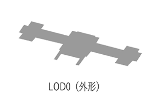
LOD0 is the most basic level of simulation, representing objects as 2D planes or lines with no height information. For example, for a building, LOD0 only shows the outline of the foundation or the roofline when viewed from above. This level is typically used as foundational data for basic planning maps or Geographic Information Systems (GIS).
2. LOD1: Volumetric Model
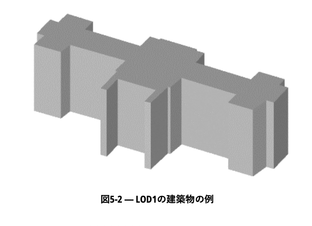
Stepping into 3D space, LOD1 represents structures as simple geometric blocks. Models at this level are created by taking the footprint outline from LOD0 and extruding it vertically to a uniform height (usually the average height of the structure). Although it lacks details like roofs, LOD1 is well-suited for macro-level analysis tasks such as calculating building density or simulating wind directions across an entire city.
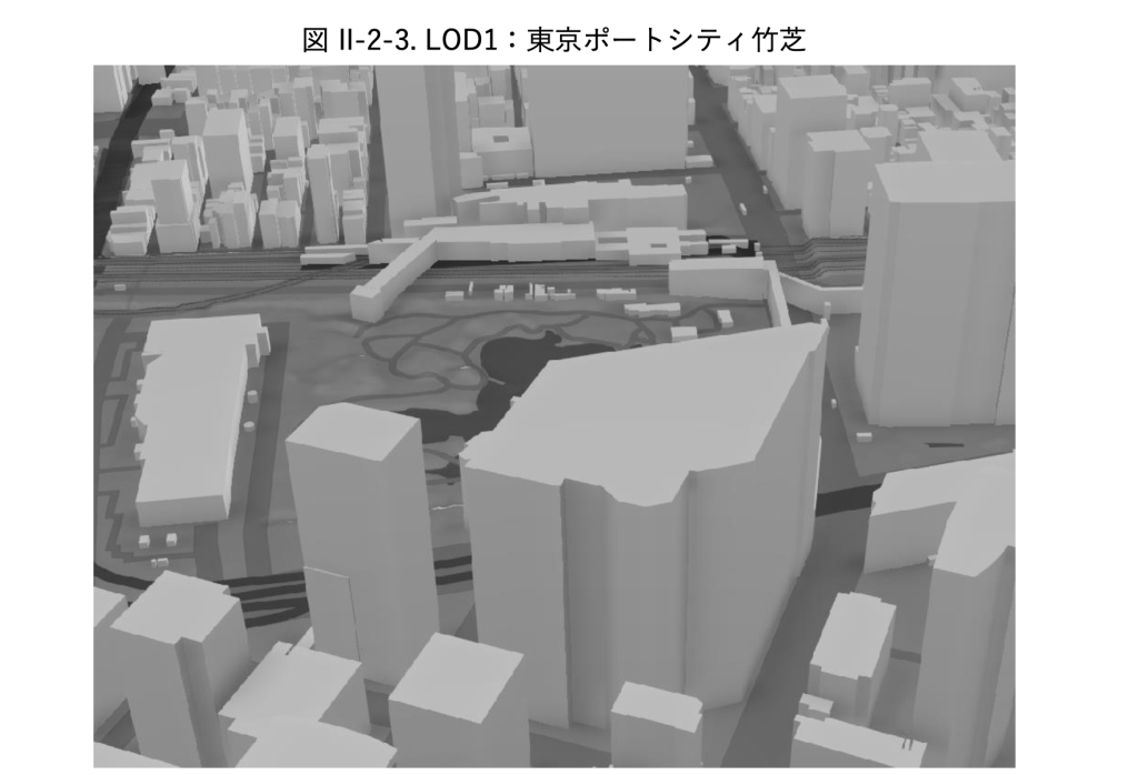
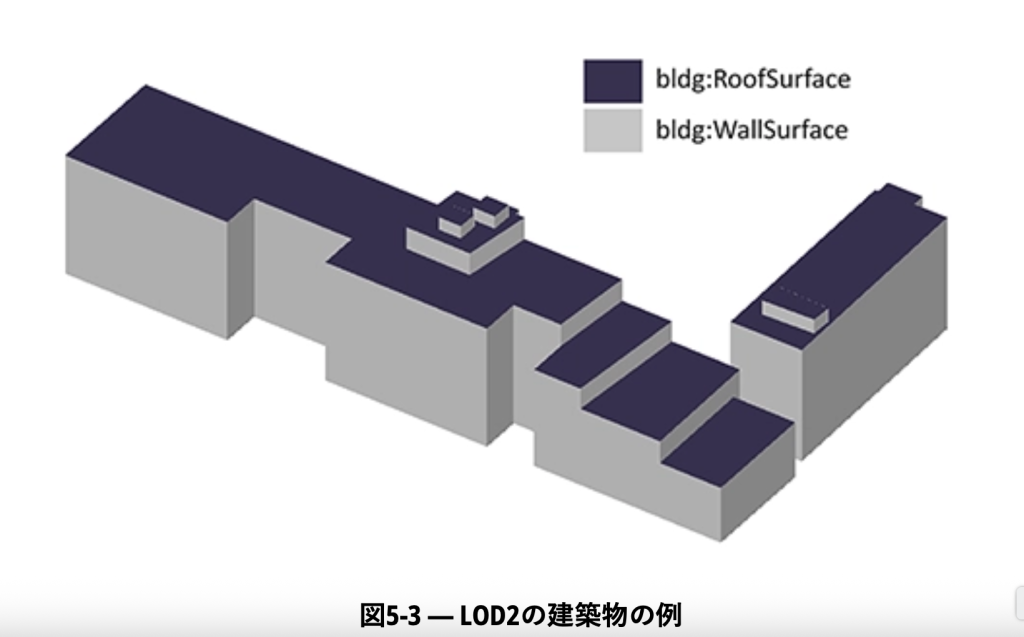
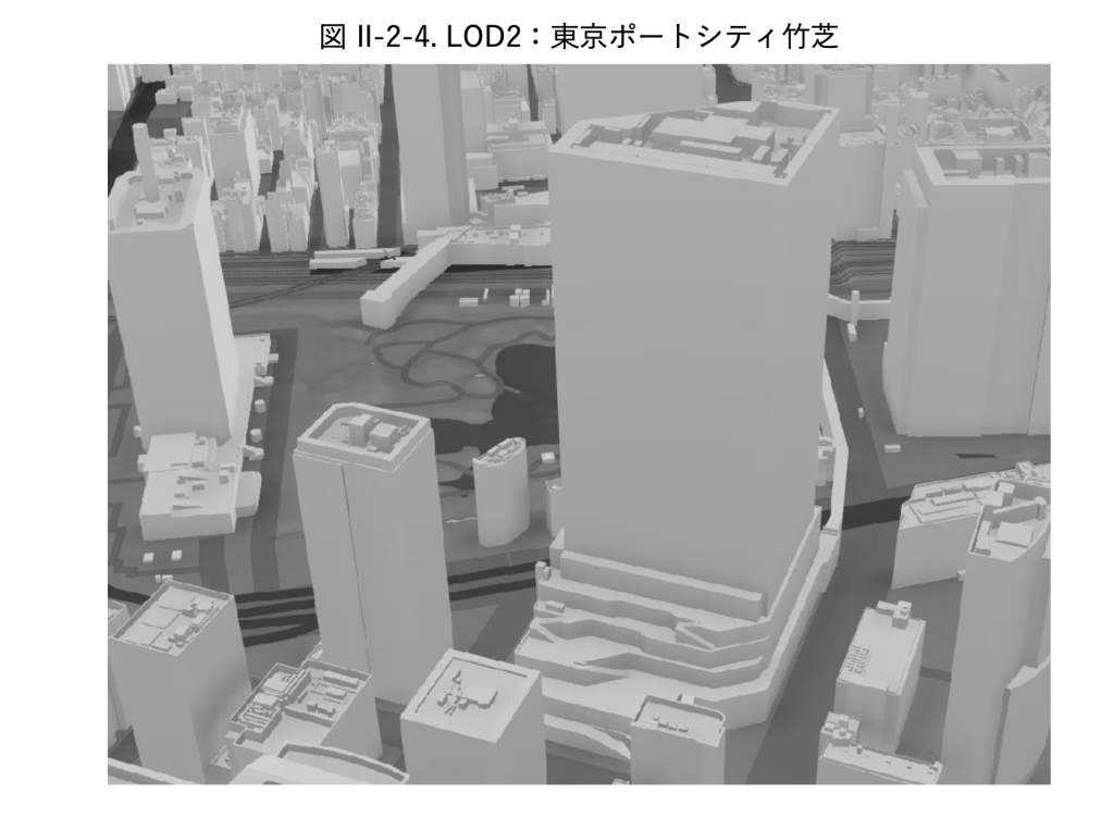
3. LOD2: Model with Roof Structure
At LOD2, the structure begins to take on a clearer shape with the specific separation of surfaces: roof, exterior walls, and base. The most prominent feature of LOD2 is its ability to reproduce detailed roof shapes (such as pitched, flat, or hip roofs), while the surrounding walls remain smooth planes. This level provides sufficient data for evaluating solar panel installation potential on rooftops or for urban landscape analysis.
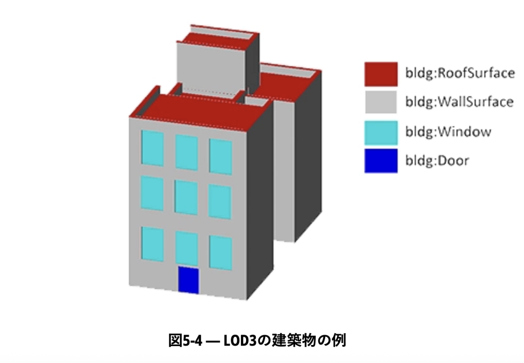
4. LOD3: Detailed Exterior Model
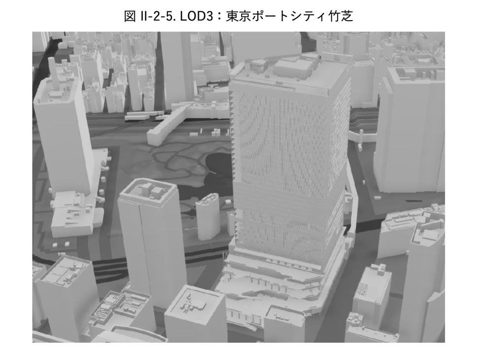
LOD3 requires a more complex level of data collection to reproduce the detailed exterior of an object. At this level, the structure’s surface is augmented with openings and auxiliary structures such as windows, doors, balconies, or canopies. With high visual accuracy, LOD3 is an essential standard for applications requiring realism, such as autonomous vehicle training, virtual/augmented reality (VR/AR) platform design, or environmental light simulation.
5. LOD4: Integrated Interior Space Model
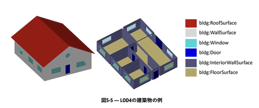
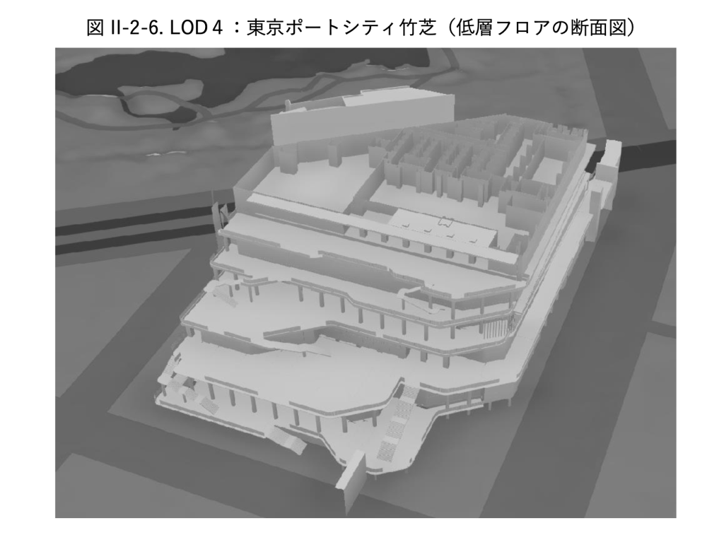
LOD4 is the highest level of completion for a 3D model. Not limited to the exterior shell, LOD4 includes the interior spatial structure of the building (Indoor Space). This level is often built through direct integration with Building Information Modeling (BIM) data. Interior details such as rooms, staircases, elevators, or even furniture can be digitally modeled in detail. Thus, LOD4 plays a vital role in asset management, building maintenance, and evacuation simulations in case of emergencies.
Notably, the LOD concept is not solely applicable to buildings. In fact, this standard is also applied to 20 different entity groups, such as bridges, tunnels, vegetation, or underground piping systems…
Choosing the appropriate LOD level is a balancing act between operational objectives and project budget. The higher the level of detail, the broader the range of applications, but concurrently, the costs of data collection and processing will increase proportionally. Therefore, businesses and management agencies need a well-structured digitization strategy from the outset.
With deep expertise and experience in applying international data standards, MH&T provides comprehensive Digital Twin solutions, directly meeting infrastructure management needs in Vietnam.
When collaborating with MH&T, clients will receive support in:
- Consulting on selecting the most optimal LOD level for each project item, ensuring economic efficiency and avoiding resource waste.
- Processing and integrating data synchronously from various sources (BIM, GIS, survey maps) into a single management platform.
- Building accurate 3D models for multiple purposes, from planning management and construction supervision to Smart City operations.
Contact MH&T’s team of experts today to build a sustainable and effective digitization roadmap for your project!