Most current reconstruction technologies focus on creating models that appear to be correct. This is perfectly suitable for presentation, entertainment, or digital content applications. But for Digital Twin problems – where models are used for measurement, spatial analysis, operational simulation, and decision-making support – geometric accuracy is a much more critical factor.
The recent boom in AI and image reconstruction tools has made creating 3D models easier than ever. However, for GIS professionals, urban planning engineers, or autonomous system developers, a truth needs to be clarified: not every 3D model can become foundational data (Ground Truth).
A Digital Twin can become a data foundation for urban management, infrastructure operation, or training physical AI systems. Conversely, a model optimized only for visual display might create a realistic feeling but lacks sufficient reliability for technical tasks.
From Raw 2D Data to 3D Space: The Quest for Depth
Whether data is collected from drones, mobile phones, 360-degree cameras, or specialized sensor platforms, the initial input remains a collection of 2D images.
These images show what the surface of a structure looks like but do not directly contain information about height, depth, or the actual distance between objects. In other words, they reflect how the world is seen, not accurately describe its geometry.
To reconstruct an environment in 3D, modern systems must solve the problem of camera pose estimation through the Structure-from-Motion (SfM) process. The algorithm searches for features that appear repeatedly across multiple overlapping images, then computes back the camera’s position and orientation at the time of data collection.
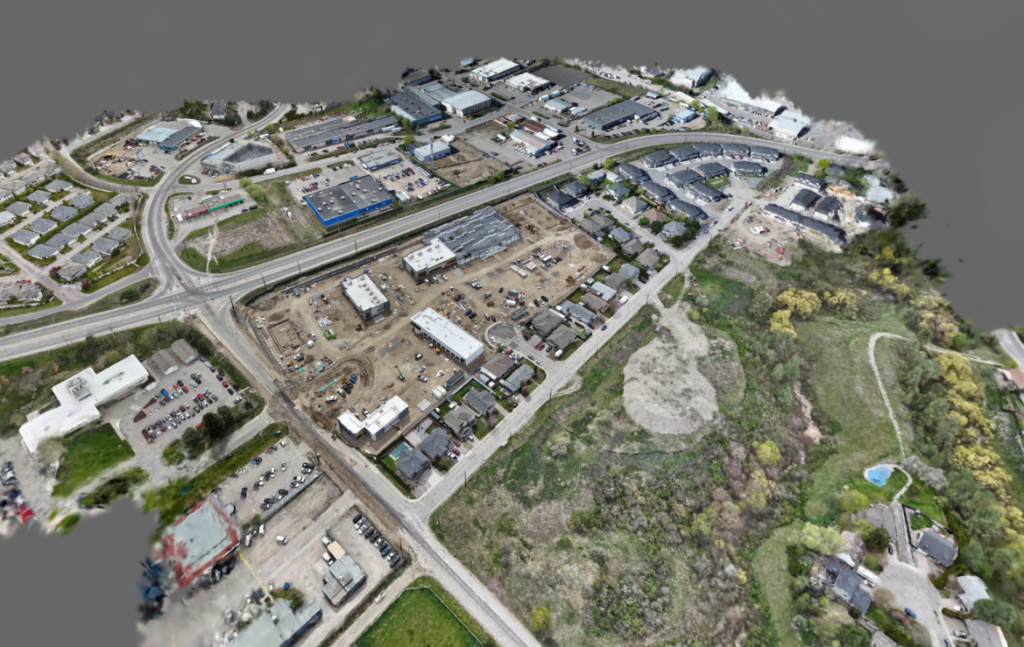
This is the foundational step of the entire reconstruction process. If camera localization errors occur – often encountered on glass surfaces, reflective metals, areas lacking texture, or blurred data – the errors will propagate to the entire subsequent 3D model.
Core Difference: Visual Optimization or Geometric Consistency?
After determining camera positions, the data will be converted into geometric representations such as Point Cloud, Mesh, or 3D Gaussian Splats (3DGS).
In recent years, 3DGS has become one of the most interesting approaches due to its ability to reconstruct images at high speed and with impressive display quality. However, optimizing image quality does not equate to ensuring geometric accuracy.
If the optimization process focuses solely on render quality, the system might produce visually very convincing models, but still contain geometric errors such as abnormal intersecting surfaces, distorted structures, gaps appearing in areas with insufficient data, or spatial scale inaccuracies.
These errors might be difficult to perceive with the naked eye. However, they become serious problems when the data is used for technical tasks such as volume measurement, rooftop area calculation, traffic corridor analysis, rescue plan simulation, or building training environments for autonomous robots.
That’s why the industry is gradually shifting from a “photo-realistic reconstruction” mindset to “geometrically accurate reconstruction.”
Many research organizations and technology companies worldwide are currently focusing on adding geometric constraints, depth estimation algorithms, and surface consistency checking mechanisms directly within the reconstruction process. The goal is not just to create realistic models but also to ensure that the model accurately reflects the physical structure of the real world.
Video: Niantic Splat Comparison
When combined with Georeferencing, a 3D model is no longer merely a graphical object but becomes a spatial data layer that can be directly integrated with GIS, BIM, and large-scale Digital Twin platforms.
From BIM to Urban Digital Twin: The Challenge of Large-Scale Data
Building an accurate model is only half the battle.
When expanding from the scope of a single building to the scale of a district, city, or entire urban infrastructure, systems quickly face the phenomenon of “geometry overload.” The volume of geometric data increases exponentially, leading to pressure on storage, transmission, and real-time display infrastructure.
This is a challenge that almost every urban Digital Twin project must address.
In the context of major cities like Hanoi, Ho Chi Minh City, or smart industrial zones pushing digital transformation, building large-scale 3D models is not just a problem of accurate reconstruction but also demands stable operation on actual infrastructure.
To address this issue, the industry is currently employing multiple approaches simultaneously.
Level of Detail (LOD) and Mesh Simplification
Algorithms such as Quadric Error Metrics (QEM) allow for reducing the number of polygons by removing details that have little impact on the overall shape. This approach significantly reduces computational costs while maintaining the necessary accuracy at each observation level.
Next-Generation Data Compression Formats
In addition to geometric optimization, many organizations are developing specialized storage formats for next-generation 3D data.
A typical example is the open-source SPZ format, which significantly reduces Gaussian Splat data size while maintaining high display quality. Similar approaches are opening up the possibility of deploying Digital Twins at a city scale without creating excessive pressure on storage infrastructure and transmission bandwidth.
More importantly, these optimized formats are increasingly compatible with popular ecosystems such as Cesium 3D Tiles, ArcGIS, and modern GIS platforms.
Perspectives from Digital Twin Implementation Practice
At SYN, we believe that geometric accuracy should be considered a core criterion in every Digital Twin project.
A 3D model truly generates value only when it can serve as a reliable data source for analysis, simulation, and operational activities. The ability to measure accurately, link to real-world coordinate systems, and integrate with GIS platforms is far more important than how many millions of polygons the model has or its level of visual realism.
In the context of cities moving towards data-driven governance, a Digital Twin should be seen as a spatial data infrastructure, not merely a 3D graphic product.
In the future, the value of a Digital Twin will not be judged by the realism of its visual display but by its ability to accurately reflect the real world and support decision-making.
Models that only appear correct might be suitable for presentation purposes. But for urban management, infrastructure operation, spatial analysis, and next-generation AI systems, what is needed are geometrically accurate models.
That is the boundary between a beautiful 3D model and a Digital Twin with real operational value.
MH&T – Experts in the field of Digital Twin
Let us perfect your ideas
Contact: 093-444-2143